
New Castle Street Search Steps
A street-by-street search works best as an address trail. Begin with one confirmed location, not a list of names. Lawrence County separates a parcel's physical location from the address where tax correspondence goes, and that distinction matters. The county records can establish ownership, a parcel relationship, a recorded transfer, or a dated historical address association. They do not establish every person presently at a location.
- Search the Lawrence County Assessment Office by the known address or owner. Save the parcel or control identifier, situs, owner mailing line, legal description if available, and the latest sale reference.
- Open the county GIS Data Parcel Viewer, find the parcel, and check its boundary and municipality. For a street segment, select nearby parcels individually rather than treating a map as a people roster.
- Use the parcel or control identifier with the Recorder's search. Preserve party roles, recording dates, document numbers, and the legal description while tracing a title record.
- For a lawful voter-information question, ask Lawrence County Elections about the specific public-information or street-list route. Pennsylvania restricts release and use, and the polling-place tool returns address geography, not names.
- For a historic association, check the dated directory and newspaper layers at the New Castle Public Library. Keep the edition and year with every address finding.
That sequence keeps an ownership clue, an address clue, and a historic person clue from being blended into one unsupported claim. It is the practical core of a New Castle by-address search.
New Castle Address Search Fields
The county's legacy parcel viewer is especially useful when a present address does not look like an older document or directory entry. Its observed criteria let a researcher begin with either an identifier or an address phrase. A match is still only a starting point. Confirm the municipality, parcel, situs, and the document's legal description before joining records from different dates.
| GIS search field | Match style | Best use | Careful reading |
|---|---|---|---|
| Control Number | Exact | Return to a known parcel | Use the identifier with Assessment and Recorder records. |
| Tax Map and Parcel Number | Exact | Link map and tax references | Retain the full number, not a shortened street label. |
| Primary Owner | Contains match | Find a known assessment party | An owner is not automatically an occupant. |
| Site Address / Full Address | Contains match | Begin a current-address search | Check the municipality and parcel after a match. |
| Legacy Full Address | Contains match | Reconcile an older address form | Verify the bridge in a dated record. |
The official NG911 Addressing service also documents separate current and legacy full-address attributes. They are mapping attributes, not evidence of a household.
Note: A search result needs the parcel and date checked before it becomes part of a street-history timeline.
New Castle Street Parcel Clues
The county-published parcel-card material shows why an address must be read field by field. It can carry Parcel Address, Owner Address, city, state, ZIP, base year, land and improvement values, status, Homestead, land description, acreage, permit information, sales history, and building-sketch information. A sale line may include an instrument number, date, validation code, price, and grantee. That inventory supplies a bridge to the deed index, but no one field turns the card into proof of present residency.
For a New Castle search by street, write down the fields that anchor the next record instead of copying every value. The most useful anchors are often:
- the physical parcel address and the municipality shown with it;
- the parcel or control identifier used by the county systems;
- the owner mailing address, kept separate from the situs;
- the sale date and instrument number that point to a recorded document; and
- the legal description or subdivision language needed for older records.
Permit columns and sketches can add property context, yet they do not establish who was at the location on a given date. Keep a source date beside every field when comparing properties along the same street.
New Castle Records by Street
Several custodians hold address-keyed records, but each answers a narrower question. Assessment and GIS establish parcel context. The Recorder supplies the documented title trail. Election information has statutory limits. City files can supply a dated project or code lead only when a known file exists. A New Castle street search is more reliable when each result stays in its own column.
| Address record | Local custodian | Useful result | Access route |
|---|---|---|---|
| Assessment parcel card | Assessment Office | Parcel and owner mailing addresses, values, sales, permits, and sketches | County-linked free property search or office |
| GIS parcel map | Assessment / GIS | Parcel location, boundary, and nearby parcel context | Public viewer |
| Recorded instruments | Register of Wills & Recorder | Parties, recording chronology, document number, and legal-description trail | Public index and Recorder counter |
| Voter public information | Lawrence County Elections | Only information lawfully released under the Election Code | Request subject to identification and written-use conditions |
| City permit or code file | City custodian | Project, applicant, and timing evidence in a known file | Targeted request or RTKL route; no citywide public search verified |
The parcel or control ID connects the assessment result to a deed search and helps distinguish similarly named places. The street name alone does not do that work. A voter record, when lawfully released, is a separate statutory record and must not be used to fill gaps in a property record.
New Castle Street Deed Trail
The Recorder's public index provides a useful route from a parcel to recorded instruments. Quick Search requires a term and permits grantor/grantee, subdivision, document-type, or document-number searching. The advanced screen adds party names, parcel/control ID, municipality, recorded date, document type, document number, book, volume, page, and full-document OCR. Start with the index fields and a narrow date range. OCR is a secondary way to look for document text.
The Recorder advanced-search screen shows the local filters used to follow an instrument from an address-based parcel lead.
The search fields support a dated property trail when the parcel/control ID, municipality, parties, and legal description agree. They do not make a street address a complete occupancy index.
County office custody reaches back to 1849, while the county describes CountyFusion online documents as approximately 1970-current. For an earlier gap, use the Recorder counter and the Pennsylvania Historical and Museum Commission guide's 1849-1963 grantor/grantee index bridge. Do not assume that a missing online image means the County has no record.
New Castle Street Number Changes
New Castle research should not assume one countywide renumbering date. The documented problem is more specific: an older deed may use a lot or subdivision description, a directory may use an earlier street form, and a New Castle postal label can apply outside the city boundary. A difficult match needs the legal description, historic map or subdivision name, cross streets, ward or municipality, and the dated address as it appears in the source.
Lawrence County's June 2023 addressing policy preserves older nonstandard numbers when they do not create emergency-response difficulty. It also distinguishes a physical 9-1-1 address from a USPS mailing last line. New primary addresses follow county numbering rules, while unit and similar secondary identifiers remain distinct. That is why an address correction does not automatically revise a parcel card, deed, election record, and historic directory at once.
Use the county 9-1-1 Addressing office for a correction path and verify any proposed bridge against a record from the target period.
Historic New Castle Street Evidence
For an older street question, the useful evidence is dated. The New Castle Public Library and Power Library make digitized directory runs available for 1872-1899, 1900-1910, 1911-1918, and 1921-1928, with documented gaps. The inspected 1900-01 Burch directory includes a real street section that records blocks, house numbers, and listed occupants on both sides. That feature belongs to that edition, not automatically to every volume.
The local history collection is the right place for a reverse-street or criss-cross lead, while the actual historical volumes remain the focus of the New Castle directory book. Pair a directory line with its edition, page, and a compatible deed, census, newspaper, or cemetery source before drawing a conclusion.
- Parcel
- A defined tract in the assessment and mapping system, commonly tracked with a control or tax-map identifier.
- Situs address
- The physical location of the land or building, which can differ from an owner's mailing address.
- Plat
- A recorded map or plan that identifies lots, blocks, or a subdivision layout.
- Criss-cross directory
- A directory arrangement that works from an address or street toward a listed name for a particular publication year.
New Castle Street Record Alerts
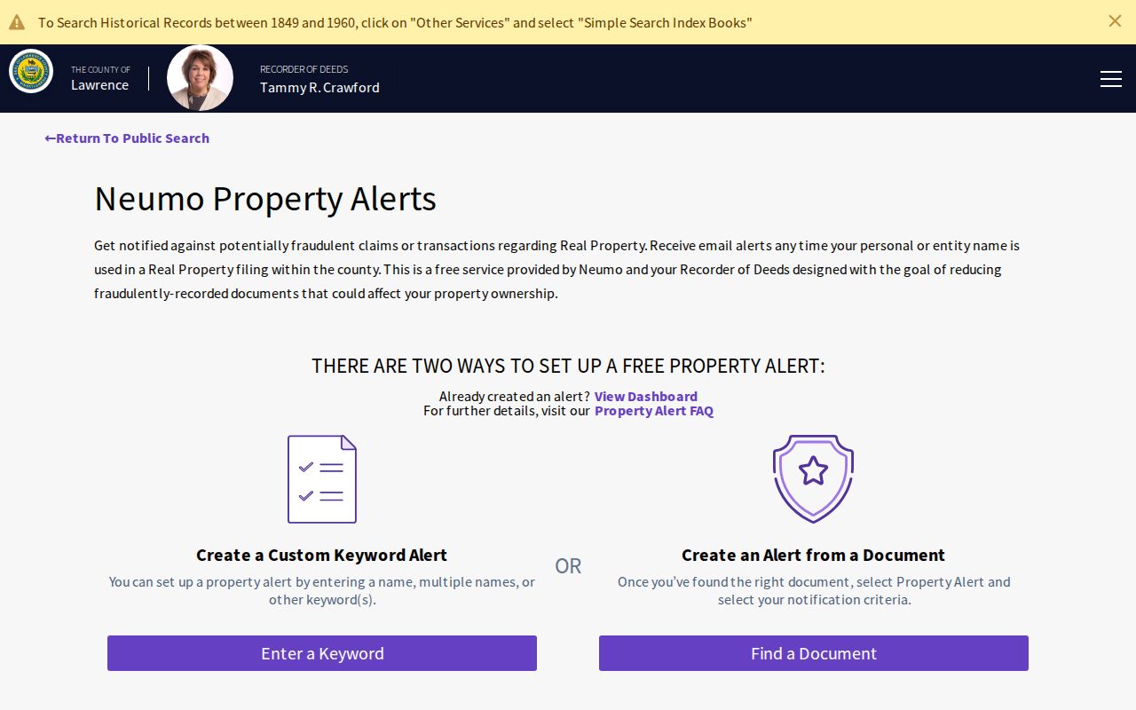
The Recorder's free Property Alert service is a defensive tool for a name or other keyword in a real-property filing. A user may enter one or more names, use another keyword, or set criteria from a located document. An alert can prompt a closer review if an unexpected filing appears, but the Recorder warns that it does not guarantee detection, completeness, or reliability.
The official Property Alert screen is the right starting point for that notification service.
When an alert arrives, preserve it, retrieve the recorded instrument, and compare its parcel/control reference and legal description with the known property. The notice is not proof by itself.
New Castle Street Jurisdiction Checks
New Castle is Lawrence County's only city, but the County's assessment system covers roughly 56,000 parcels across 367 square miles and 27 municipalities. A New Castle mailing label cannot replace the municipality, ward, tax district, or parcel fields. The city has eight wards, and those local geography fields should be read separately from a postal label.
For a city-created file, use the City of New Castle's custodian or its Right-to-Know route. A county parcel search cannot answer every municipal record question. For a county record, a precise request naming the address, time period, and file category makes the response easier to identify and preserves the difference between a city file and a county file.
Note: The same mailing label can appear across different local jurisdictions, so record the municipality shown by the official source.
New Castle Street Search Limits
A current parcel result is not a resident roster. It can show a property address, owner correspondence address, and assessment context, but it cannot identify every household member, a utility customer, or someone with a protected location. A recorded instrument is also not automatic proof of current ownership or occupancy. Pennsylvania's Address Confidentiality Program protects qualifying participants' actual locations, and those safeguards must be respected.
Election records have their own rules. Sections 1207 and 1404 of the Pennsylvania Election Code condition public-information access and restrict use. Ballot selections, signatures, SURE registration numbers, and protected actual addresses are not available through a street search. A name or address match deserves independent, date-specific confirmation.
Lawful use. Use New Castle street records for personal research, property history, civic context, or family history. Do not use an address trail to stalk, harass, intimidate, or harm anyone.