
New Castle ZIP Code Coverage by Address
New Castle appears in several postal contexts. The verified labels below are useful starting points, not a street-by-street delivery map. Postal lines can cross the City of New Castle boundary, and city parcels can share a broader New Castle mailing label with nearby municipalities. The county is especially clear about this distinction: its records use separate municipality, ward, district, situs, and mailing fields. Check those fields after confirming the exact address with USPS.
| ZIP | Verified local context | Postal location | Use with care |
|---|---|---|---|
| 16101 | County center, Downtown New Castle, city, and library addresses | Downtown New Castle postal location | A core local label, not proof that every address is inside city limits or in one ward. |
| 16102 | New Castle-area standard ZIP in county and Census address contexts | Not separately verified in the research | Validate the full address before treating it as a delivery or municipal area. |
| 16103 | Documented local post-office-box mailing context | Box-mail context | It is not a street-address geography or evidence of a physical location. |
| 16105 | New Castle postal label used at actual county-source addresses, including the vital-records office area | Not separately verified in the research | Do not infer city government, ward, or delivery extent from the label alone. |
| 16107 and 16108 | Service-related New Castle ZIP contexts identified through USPS location information | Check USPS for the exact mailing or physical address | Neither label establishes citywide coverage or municipal membership. |
No authoritative static USPS polygon table in the research assigns every New Castle street to one ZIP. That gap matters. A ZIP label is a postal aid, not a substitute for the municipality and parcel-control fields that county record systems use.
New Castle Postal Labels Before Records
Use the USPS ZIP Code Lookup with the complete address before searching a county record. The official postal resolver is address-specific. A broad map label or a five-digit ZIP alone cannot tell whether a property lies inside the City of New Castle, in a particular ward, or in a neighboring jurisdiction. Keep the USPS result beside the full street address, rather than replacing the address with a ZIP shorthand.
The USPS Downtown New Castle location page is the source for the postal-location image below.
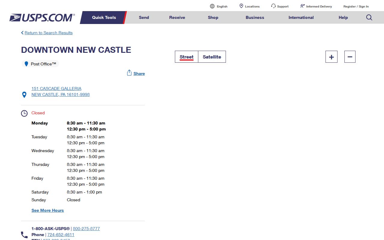
The image confirms a postal location using the 16101 label. It does not draw the boundary of that ZIP or identify the city government for every address using the same mailing line.
For aggregate mapping only, Census ZIP Code Tabulation Areas approximate five-digit postal geography. A ZCTA is not a USPS delivery route and has no authority over city limits, tax districts, precincts, or wards.
New Castle ZIP Code Search Workflow
There is no verified countywide resident or property search that accepts a ZIP-only filter in the research. Do not promise one. Instead, use a confirmed full address to move between the postal, parcel, and ownership systems. This narrower route is more reliable because the county keeps a physical situs, owner mailing address, municipality, and parcel identifier as separate pieces of information.
- Confirm the complete street address and ZIP with USPS. Save the result with the street number and street name.
- Open the county Assessment Office route and its linked search tools to find the parcel or control number, municipality, situs, and owner mailing fields for that address.
- Use the GIS Data Parcel Viewer to inspect the parcel boundary and its relationship to nearby parcels. The GIS is a map path, not a ZIP-wide list.
- When ownership history matters, search the Recorder public index by the party, parcel/control identifier, municipality, document number, or a date range that the record supports.
A ZIP can narrow where to start, but it does not replace the address. The New Castle ZIP code directory remains an address-by-address reference. Once the question shifts to every property along a named road, the New Castle street directory provides the address-by-address record path.
Note: The county GIS inspection did not verify a ZIP filter, buffer tool, or complete popup menu, so each live tool should be checked before relying on an unlisted option.
New Castle ZIP Fields in County Records
County records can carry a ZIP as part of a mailing or addressing field without making it a search key. The published assessment-card extract shows a parcel address, owner address, city/state/ZIP, homestead and status indicators, sale history, instrument number, and building information. Its value for ZIP research is context: it helps separate where the land is located from where a tax notice is sent. It cannot identify every person at the address.
| Record field | What it helps establish | What it cannot establish |
|---|---|---|
| Parcel or situs address | The land or building tied to the assessment record | Every member of a household |
| Owner mailing address | Where assessment correspondence is directed | That the owner occupies the parcel |
| Municipality, district, and ZIP context | Which geographic labels appear in the record | A single legal boundary from the postal label |
| Parcel/control ID | A stable bridge to GIS and Recorder searches | A current-residency conclusion |
The county NG911 addressing layer also documents attributes such as current and legacy full address, postal community, ZIP, ZIP+4, municipality, building, unit, and UPI. Those are mapping attributes. Use the NG911 Addressing service metadata to understand the field distinctions, then ask the appropriate office to correct a field rather than editing a different agency's record.
The New Castle ZIP code directory does not treat that documented field set as a ZIP-only search screen. The county's public Assessment Search is described as a free property search, but the research could not inspect its live field labels or confirm partial-match behavior. The legacy GIS inspection did verify exact control number and tax-map/parcel criteria, contains-match primary-owner and site-address fields, plus a legacy-full-address field. Use the address-oriented criteria that are documented, and verify any live ZIP option before relying on it.
New Castle ZIP Code Limits and City Lines
The City of New Castle has its own boundary and eight wards. Lawrence County has 27 municipalities, and a New Castle mailing label can appear outside the city government. The reverse is also possible in record work: a city parcel's postal label does not identify its precinct, ward, tax district, or Census tract. A city name in a mailing line is useful, but it is not the field that decides jurisdiction.
- ZIP code
- A five-digit postal label used to help route mail. It is not a municipal boundary.
- ZIP+4
- An added four-digit delivery detail associated with a more specific postal address. It does not replace the five-digit ZIP's limits.
- PO-box ZIP
- A mailing context assigned to post-office boxes, not proof of a street location or residence area.
- Carrier route
- A USPS delivery grouping. It is not a ward, parcel boundary, voter district, or public roster.
When a postal label and a county record appear to disagree, compare the exact street address, municipality, parcel/control number, and record date before treating either one as wrong. A mailing format can be correct for postal use while the parcel remains outside the City of New Castle.
New Castle Wards Need More Than ZIP
New Castle is Lawrence County's only city and is organized into eight wards. That makes a ZIP-based starting point especially incomplete for civic or property research. County assessment, GIS, 9-1-1 addressing, and tax records use their own jurisdictional fields. If a record merely says New Castle, verify the municipality and any ward, district, or tax field before treating the address as city property.
The county polling-place lookup can return a precinct and polling location for an address. It clarifies election geography, but it is not a resident list and does not permit an inference about a person's registration, affiliation, vote, or household.
Note: A mailing label, parcel address, owner address, and polling geography may all be valid records while describing different parts of the same location.
New Castle ZIP Codes and Older Addresses
Older New Castle records may use a different street form from a current mailing address. The county's June 2023 addressing policy permits older nonstandard numbers to remain when they do not create emergency-response difficulty. County mapping can distinguish a current full address from a legacy full address, while USPS controls mailing formatting. Neither layer automatically changes a dated directory, deed, tax record, or voter record.
For an older address, compare the current 9-1-1 address and municipality with the legacy-address field, parcel/control ID, current situs, legal description, a dated directory line, and map context. The 1900-01 directory supports historic street listings for that year only. It can help reconcile an old block, but it cannot prove a present address or current household.
New Castle ZIP Code Help Channels
For an address assignment, street-name change, correction, or legacy-number question, contact Lawrence County Planning and 9-1-1 Addressing. Its page describes the county's role in most county addressing work and identifies North Beaver Borough as an exception. Bring the access road or street, driveway location, parcel/control number, municipality, building or unit description, and the existing mailing label.
For an assessment or parcel discrepancy, the Assessment Office is the record owner. For a deed or legal-description issue, use the Recorder's online index or counter. A known city permit, code, or zoning file belongs with the City department that created it, using the City of New Castle office or a focused Right-to-Know request. There is no confirmed citywide online permit or code search. A specific file request should name the address, date range, and record type.
Postal questions belong with USPS. County property questions belong with Assessment, GIS, or the Recorder. That division keeps a ZIP code directory from treating one label as an answer to every kind of address question.