
New Castle Neighbors: Block Record Sources
Start with the address and ask a narrow question. A parcel map answers which parcels touch or sit near the target. An assessment card can identify the named owner and mailing address for one parcel. The Recorder can supply a dated title trail. Each source has a different role, and none turns an ownership field into proof that every occupant is a neighbor. The table separates the available block-level paths from claims the records cannot support.
| Source | Block-level contribution | Access path |
|---|---|---|
| County GIS parcel map | Parcel adjacency, boundaries, and spatial relationship around an address | Public GIS Data Parcel Viewer |
| Assessment record | Parcel, owner mailing address, valuation, and selected property fields for one parcel | Assessment Office search route or counter |
| Recorder index | Recorded parties, instruments, chronology, and legal-description clues | Public index or Recorder counter |
| Election commission | Lawful street-list or public-information request mechanism, subject to statute | Lawrence County Elections |
| Historical directories and maps | Dated occupant, address, and block context for the year of the source | NCPL, Power Library, or Historical Society research access |
Owner, mailing addressee, voter, historical directory entrant, and current occupant are distinct roles. A nearby parcel might have an out-of-area owner, a tax mailing address, or a recorded transfer that says nothing about present occupancy. Keep the source date and its role with each note.
Map a New Castle Block Parcel by Parcel
The county's documented adjacent-parcel method is deliberately individual. Find a known address, follow the map or search result to its parcel, and visually select contiguous or nearby parcel polygons. Record each control identifier and situs before looking at an assessment or title record. This avoids copying a broad block and losing the municipal line, parcel boundary, or date that gives a record meaning.
- Locate the known address in the county GIS or Assessment route. Confirm the municipality and the parcel or control identifier.
- Inspect the adjoining or nearby polygons one by one in the GIS. Record the situs and control ID for each parcel you are actually comparing.
- Use Assessment Search or the counter for the owner and mailing-address fields. Treat the mailing line as correspondence information, not a list of people who live there.
- For a dated title question, use the Recorder index with the parcel/control ID, municipality, a party name, document number, or a bounded recorded-date range.
- Stop when the source cannot answer the question. The research did not verify a buffer, radius, measurement, or export control in the live GIS viewer, so do not rely on an unconfirmed feature.
The record flow is address to parcel or control ID, then Assessment and GIS, then Recorder instrument history. It is a parcel-and-title method, not a current household roster. For a whole named road rather than the immediate block, use the New Castle street directory record chain.
Note: A boundary on the map establishes a spatial relationship, while a recorded document establishes a dated title event; neither alone proves present residency.
New Castle Parcel Fields and Title Trails
The Assessment Office describes its work as real-property valuation, record maintenance, mapping updates, deed-transfer analysis, and construction review. Its published parcel-card extract distinguishes a physical parcel address from an owner address. That distinction is essential for New Castle neighbors research. The situs identifies land or a building. The owner address is where assessment correspondence is directed and may be somewhere else.
| Field or record | Useful reading | Limit |
|---|---|---|
| Parcel address and control ID | Links the location to assessment, GIS, and Recorder work | Does not name every occupant |
| Owner address and homestead field | Shows the assessed owner and mailing context | Does not guarantee owner occupancy or household membership |
| Sales history and instrument number | Provides a bridge to a dated Recorder search | Does not explain every transfer or personal relationship |
| Grantor and grantee | Names the parties in a recorded land transaction | Does not, by itself, prove either party lived at the parcel |
A grantor is the party conveying an interest in land. A grantee is the party receiving it. Search the Recorder's advanced index with the parcel/control number and municipality when available, then preserve the recording date, document number, and legal-description clues. The office holds physical real-estate records from 1849, while CountyFusion is described as approximately 1970-current. At an online cutoff, use the Recorder counter or the PHMC deed-index route rather than filling a gap with a name match.
New Castle Voter Data Has Strict Limits
Pennsylvania's Election Code does not make the individual voter-status service a by-street directory. Under 25 Pa.C.S. §1207, registration commission records, street lists, and specified election material are open to inspection subject to preservation and regulation. Section 1404 describes a public-information list that may contain items such as name, address, date of birth, voting history, and voting districts, while excluding digitized signatures and SURE registration numbers.
For a lawful public list or street-list request, the county election office is the access channel. The request is subject to identification and a written statement limiting use to elections, political activities, or law enforcement. Call the Election Bureau before requesting a list to confirm the current form, period, delivery medium, fee, and certification. The state registration-status service is for a person checking their own registration and polling context, not for building a block roster.
The county's address-based polling-place lookup returns precinct and polling location for an entered address. It can clarify geography. It does not show residents, ballot choices, signatures, protected addresses, or a person's affiliation.
Historic New Castle Neighbors by Directory Year
Historical neighbor work needs a date on every line. Power Library's New Castle collection includes an openly viewable 1900-01 Burch directory with a real street directory. It records street blocks, numbers, and occupant names on both sides for that edition. That makes it a strong, narrow source for comparing adjacent addresses in 1900-01, not a source for a present-day block list. Preserve the volume, year, and page, then validate a finding with another dated record.
The Power Library 1900-01 street-directory text is the source for this New Castle neighbors image.
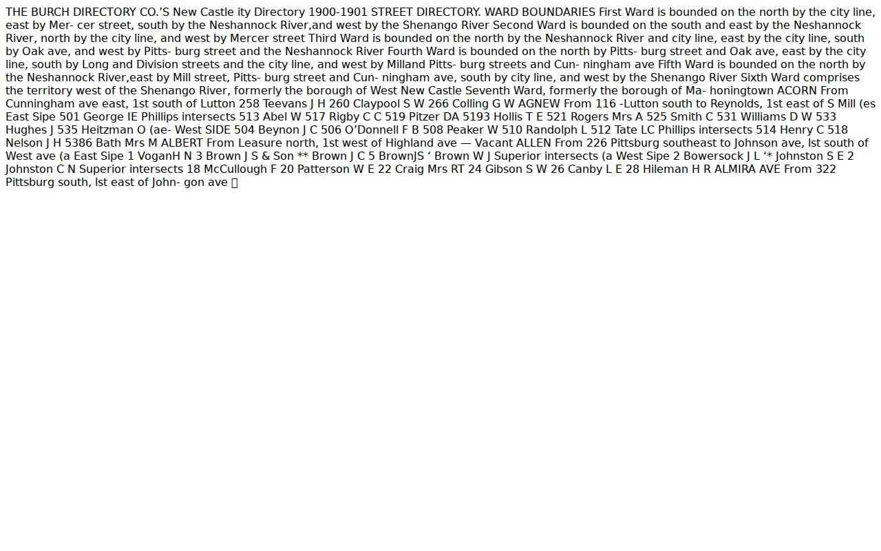
The scan shows why a dated street directory should be read as an historical snapshot. It may list a number and occupant on both sides of a street, but later address changes, ownership changes, and the passage of time limit its use to the edition shown.
Digitized directory runs are documented for 1872-1899, 1900-1910, 1911-1918, and 1921-1928, with gaps. Where the digital collection ends or lacks a needed year, the New Castle Public Library's Nicolls History Room and the Lawrence County Historical Society hold original local-history materials. Do not assume every directory contains a reverse street section.
New Castle North Hill Blocks in Context
North Hill gives historic-block research a useful local frame. The City's zoning material describes the North Hill Historic Overlay District immediately north of the business district as about 449.7 acres on a 91-block grid, with roughly 1,680 buildings dating from 1890 to 1949. Its street grid and sidewalks are described as substantially unchanged since at least 1904. Those facts help select the right map or directory year. They do not identify any current household.
For a historic block, pair a dated city-directory line with a map or appraisal source instead of projecting a modern parcel map backward. The Historical Society has county maps from 1885 to 1931, and the Library of Congress has New Castle Sanborn maps for 1888, 1904, 1905/1955-republished, and 1941. Use the North Hill overlay ordinance for district context, not as evidence about any person.
New Castle Community Sources Without Rosters
No authoritative citywide neighborhood-association or HOA directory with member records was located in the research. That negative finding is important. Do not invent association names, claim a public roster, or treat private membership and contact details as public. A group may publish its own information, but the county and city sources reviewed did not establish a general New Castle association directory.
Two documented public institutions can provide historical community context without becoming a roster of current neighbors.
New Castle Public Library
The Donald J. Nicolls History Room holds city directories, yearbooks, newspapers, local histories, cemetery material, and family histories. It is staff-assisted, and limited requests need exact citations.
Genealogy Department, 207 E. North Street, 724-658-6659 ext. 129.
Lawrence County Historical Society
The Medure Annex holds maps, deeds, wills, directories, school yearbooks, and reference works useful for dated block context. Independent research is free; advance contact is advised.
Research facilities, 408 N. Jefferson Street, 724-658-4022.
These access channels support a cited historical question. They do not supply a current association membership list or authorize copying private contact information.
New Castle Neighbors: Official and Commercial Tools
Official parcel and title records are limited but traceable to the office that keeps them. Commercial neighbor-lookup tools can be convenient, yet they may combine old addresses, owner information, and other material without showing the record date or custodian. For a block question, the useful comparison is not speed alone. It is whether a result can be traced to a parcel, a dated instrument, or a specific historical source.
| Official record route | Commercial neighbor tools |
|---|---|
| Links a claim to a county custodian, parcel, map boundary, or recorded instrument. | May merge material from multiple dates and sources with unclear provenance. |
| Shows a defined role, such as owner, mailing addressee, or recorded party. | May blur those roles into a broad label that needs independent checking. |
| Provides a counter, office phone, or formal request route when the online result is incomplete. | Does not replace the custodian's correction process or a protected-address rule. |
The best practice is to keep a parcel-control number, document number, or dated directory citation with the note. That allows a factual error to go back to the record owner instead of spreading from one unverified list to another.
Privacy Boundaries for New Castle Neighbors
Pennsylvania's Right-to-Know Law opens many agency records, but it does not make every name or address unrestricted bulk information. An agency must determine the responsive record, confidentiality provision, and needed redactions. The Pennsylvania Address Confidentiality Program gives qualified participants a substitute address. Do not seek, publish, or attempt to reverse an actual protected address through linked local sources.
Utility and delivery information are not a public block list. Nor does an assessment record settle every household member. Protected voter information, signatures, SURE registration numbers, dates of birth, minor information, and sensitive attachments are outside the ordinary block-research path. A public index can be useful while still requiring careful treatment of its limits.
For address-safety information, use the Pennsylvania Address Confidentiality Program. A factual correction belongs with the agency that owns the field, not with a different directory or map.
New Castle Address Questions by Custodian
Send the question to the office that created the record. Assessment handles parcel and owner-mailing data. GIS supplies parcel-map context. The Recorder holds recorded title material. Elections handles the lawful public-information process. The City handles a known municipal permit, code, or zoning file, but no citywide online permit or code search was confirmed. For a defined city file, contact the City department or submit a focused Right-to-Know request with the address, date range, and record type.
For a current or legacy 9-1-1 address problem, contact Lawrence County Planning and 9-1-1 Addressing. A correction can require the access road or street, driveway location, parcel/control number, municipality, building or unit description, and current mailing label. Changing one agency's field does not automatically update every other system.
Note: Keep a narrow request tied to one address, one date range, and one record type so the right New Castle custodian can identify the responsive file.